Downtown and Midtown, the city's Core City planning district from the riverfront to East Parkway, span ZIP codes 38104 and 38103 and are mostly zoned for Central High.
Last checked Oct. 18, 2026. Sources: the City of Memphis’s Memphis 3.0 planning districts and district boundary layer, the Memphis 3.0 Comprehensive Plan, 2021 update (PDF), the city’s parks layer, Memphis-Shelby County Schools’ School Zone Locator, the Tennessee Department of Education’s 2024-25 letter grades, the Zillow Home Value Index, 2020 Census block counts and OpenStreetMap. Memphis 3.0 planning office: 901-636-6601.
The city’s Memphis 3.0 comprehensive plan puts Downtown and Midtown in one planning district, Core City, which the plan says “consists of Downtown and a diverse set of neighborhoods” and is home to some of the city’s medical and educational institutions, large employers and historic neighborhoods. About 50,500 people lived in it at the 2020 census, in about 30,200 homes, by our count of Census blocks inside the district line.
What this means for you
- High school: about 61% of residents are zoned for Central High; the rest mostly for Manassas High or B. T. Washington High.
- Home value: Zillow’s typical value in ZIP code 38104 was $248,684 in September 2026; downtown’s 38103 was $319,364.
- Interstate: I-240 Exit 30 (Union Avenue) is about half a mile from the district’s population center.
Where it is
On the city’s district map, Core City runs from the Mississippi River riverfront east to East Parkway and a rail line, and from A. W. Willis Avenue, Jackson Avenue and North Parkway on the north to E. H. Crump Boulevard and South Parkway East on the south. I-240 runs through the middle, between downtown and Midtown. Main streets include Union Avenue, Poplar Avenue, Madison Avenue, Cleveland Street and Cooper Street. About 44% of residents are in ZIP code 38104, 18% in 38103, 11% in 38105, 9% in 38112, 7% in 38114 and 6% in 38126.
The plan’s district map of places residents named in workshops shows Downtown, South Main, The Edge, Uptown, the Medical District, Midtown, Speedway Terrace, Snowden, Idlewild, Central Gardens, Cooper-Young, Rozelle-Annesdale, Glenview, Castalia, South Bluffs and Washington Heights. The comprehensive plan names the Pinch District and Crosstown as urban centers, with neighborhood crossings at Lauderdale and Vance, Mississippi and Georgia, Poplar and Alabama, Ayers and J.W. Williams, Poplar and Cleveland and Netherwood and Willett. It says new building in historic districts goes through the Memphis Landmarks Commission.
Schools
Memphis-Shelby County Schools assigns schools by address. In the zone data behind its School Zone Locator:
| School | Address | Share of 2020 residents zoned | 2024-25 state grade |
|---|---|---|---|
| Central High | 306 S. Bellevue Blvd. | 61% | B |
| Manassas High | 1111 N. Manassas St. | 18% | D |
| B. T. Washington High (grades 6-12) | 715 S. Lauderdale St. | 17% (high), 32% (middle) | D |
| Hamilton School | 1478 Wilson St. | 31% (middle) | F |
| Bellevue Middle | 575 S. Bellevue Blvd. | 13% | B |
| Snowden Elementary/Middle | 1870 N. Parkway | 12% | D |
| Downtown Elementary | 10 N. Fourth St. | 25% | C |
| Bruce Elementary | 581 S. Bellevue Blvd. | 21% | F |
| Idlewild Elementary | 1950 Linden Ave. | 20% | B |
| Peabody Elementary | 2086 Young Ave. | 8% | C |
Smaller parts are zoned for Hamilton High, Caldwell-Guthrie and LaRose Elementary. Grades are from the Tennessee Department of Education’s 2024-25 A-F letter grade file; addresses are from the federal NCES school directory. Check one address in the locator. More in our schools guide.
Home values
According to the Zillow Home Value Index (Zillow Research):
| Area | September 2026 | September 2025 | Change |
|---|---|---|---|
| ZIP code 38104 | $248,684 | $262,221 | -5.2% |
| ZIP code 38103 | $319,364 | $334,944 | -4.7% |
| ZIP code 38105 | $107,372 | $107,977 | -0.6% |
| ZIP code 38112 | $120,382 | $131,443 | -8.4% |
| City of Memphis | $151,794 | $156,121 | -2.8% |
The index is a modeled typical value for the middle third of homes, not a sale price. More in our home prices guide.
Parks and trails
From the city’s parks layer:
- Overton Park, about 238 acres in Midtown.
- Frank Tobey Park, about 43 acres, and the Mid-South Fairgrounds site, about 49 acres.
- Tom Lee Park, about 33 acres on the downtown riverfront.
- Glenview Park, about 24 acres, 1141 S. Barksdale St.
- Robert Church Park, 402 Beale St.; Health Sciences Park, on Madison Avenue; Winchester Park, 660 Lane Ave.; and Williamson Park, 292 Williamson St.
Libraries: the Cossitt Library at 33 S. Front St. and the Cornelia Crenshaw Branch at 531 Vance Ave. More in our parks and trails guide and Beale Street guide.
Getting around
- Interstates: from the district’s population center, I-240 Exit 29 (Crump Boulevard and Lamar Avenue) is about 0.3 mile, Exit 30 (Union Avenue) about half a mile and Exit 31 (I-40 west toward Little Rock, Arkansas) about 0.7 mile, as the crow flies (OpenStreetMap).
- Distances: about 2.5 miles by road to City Hall and 8.2 miles to Memphis International Airport, measured on the OpenStreetMap road network from the district’s population center in Midtown. These are distances, not drive times.
- Buses: in the Memphis Area Transit Authority’s latest public schedule data we could download (a February 2025 feed), 16 routes stop in the district, led by Route 2 Madison, Route 34 Central and Walnut Grove, Route 50 Poplar, Route 1 Union and Route 36 Lamar. Check the MATA routes page or call 901-274-6282. The trolley lines are covered in our getting around guide.
Groceries and everyday stores
From OpenStreetMap:
- Kroger, 1366 Poplar Ave. and 1761 Union Ave.
- Cash Saver, 1620 Madison Ave.
- The Fresh Market and CVS Pharmacy, on South Cooper Street.
- Viet Hoa Food Market, 40 N. Cleveland St.
- South Point Grocery, 136 Webster Ave.
- Walgreens, 987 and 1863 Union Ave.
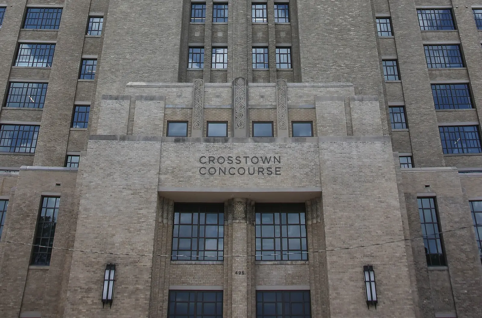
- Madison Pharmacy, 1350 Concourse Ave., at Crosstown.
More neighborhoods
Downtown and Midtown are among the areas in our Memphis neighborhoods guide. Next door: North Memphis to the north, the University District to the east and South Memphis to the south.
Map data © OpenStreetMap contributors. District boundaries and parks: City of Memphis. School zones: Memphis-Shelby County Schools. Population and ZIP codes: U.S. Census Bureau.
Frequently asked questions
What neighborhoods are in Midtown Memphis?
The city’s Memphis 3.0 plan puts Downtown and Midtown in one Core City District. Its map shows Downtown, South Main, The Edge, Uptown, the Medical District, Midtown, Speedway Terrace, Snowden, Idlewild, Central Gardens, Cooper-Young, Rozelle-Annesdale, Glenview, Castalia, South Bluffs and Washington Heights.
What high school serves Midtown Memphis?
Mostly Central High, 306 S. Bellevue Blvd.: about 61% of the district’s 2020 residents were zoned there in Memphis-Shelby County Schools’ zone data. Central earned a B on Tennessee’s 2024-25 letter grades. Parts of the district are zoned for Manassas High and B. T. Washington High.
What is the typical home value in Midtown Memphis?
In ZIP code 38104, which covers most of Midtown, Zillow’s typical value was $248,684 in September 2026, down 5.2% in a year. Downtown’s 38103 was $319,364, according to the Zillow Home Value Index.
How many people live in Downtown and Midtown Memphis?
About 50,500 at the 2020 census, in about 30,200 homes, by our count of Census blocks inside the city’s Core City planning district.
Have your say