South Memphis, the city's South planning district from the Mississippi River to Airways Boulevard, is mostly ZIP code 38106 and zoned for Hamilton High.
Last checked Oct. 18, 2026. Sources: the City of Memphis’s Memphis 3.0 planning districts and district boundary layer, the Memphis 3.0 Comprehensive Plan, 2021 update (PDF), the city’s parks layer, Memphis-Shelby County Schools’ School Zone Locator, the Tennessee Department of Education’s 2024-25 letter grades, the Zillow Home Value Index, 2020 Census block counts and OpenStreetMap. Memphis 3.0 planning office: 901-636-6601.
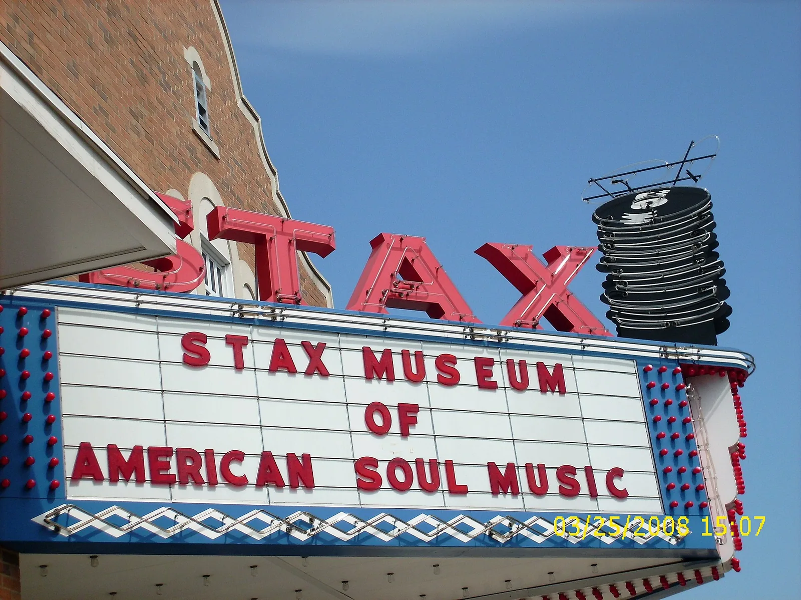
South Memphis is the city’s South District in the Memphis 3.0 comprehensive plan, from the Mississippi River east to Airways Boulevard and home to Soulsville and the Stax Museum of American Soul Music. About 34,500 people lived in it at the 2020 census, in about 16,800 homes, by our count of Census blocks inside the district line.
What this means for you
- High school: about 88% of residents are zoned for Hamilton High, 10% for B. T. Washington High.
- Home value: Zillow’s typical value in ZIP code 38106 was $54,692 in September 2026.
- Interstate: I-240 Exit 28A (South Parkway East) is about 0.6 mile from the district’s population center.
Where it is
On the city’s district map, the South District runs from E. H. Crump Boulevard and I-55 near the river on the north to Nonconnah Creek on the south, and from the Mississippi River on the west to a rail line, Airways Boulevard and I-240 on the east. Main streets inside include South Third Street, Lauderdale Street, Mallory Avenue, Walker Avenue and South Parkway. About 61% of residents are in ZIP code 38106, 17% in 38114, 13% in 38109 and 8% in 38126.
The plan’s district map of places residents named in workshops shows French Fort, Washington Heights, Riverview, Mallory Heights, Hamilton, Castalia Heights, Prospect Park and Alcy-Ball, with Soulsville marked as an asset. The comprehensive plan says the district has a high rate of building and land vacancy, could take 149 new housing units a year, and that nearly 26% of households do not have a car. It names neighborhood main streets at Mississippi and Walker, Third and Belz/Mallory Heights, Lauderdale and Mallory, South and Alcy Ball, Neptune and Walker and Elvis Presley and Alcy, and asks for the South Memphis Greenline to move sooner.
Schools
Memphis-Shelby County Schools assigns schools by address. In the zone data behind its School Zone Locator:
| School | Address | Share of 2020 residents zoned | 2024-25 state grade |
|---|---|---|---|
| Hamilton High | 1363 E. Person Ave. | 88% | D |
| B. T. Washington High (grades 6-12) | 715 S. Lauderdale St. | 10% | D |
| Riverview Elementary/Middle | 241 Majuba Ave. | 46% (middle), 11% (elementary) | F |
| Hamilton School (pre-K to 8) | 1478 Wilson St. | 39% (middle), 20% (elementary) | F |
| Cummings Elementary/Middle | 1037 Cummings St. | 9% | F |
| A. B. Hill Elementary | 345 E. Olive Ave. | 29% | F |
| Alcy Elementary | 1750 E. Alcy Road | 18% | D |
| LaRose Elementary | 864 Willoughby St. | 7% | D |
In the zone data, about 6% of residents live in areas marked “please call district office” for elementary school; call Memphis-Shelby County Schools at 901-416-5300. Grades are from the Tennessee Department of Education’s 2024-25 A-F letter grade file; addresses are from the federal NCES school directory. Check one address in the locator. More in our schools guide.
Home values
According to the Zillow Home Value Index (Zillow Research):
| Area | September 2026 | September 2025 | Change |
|---|---|---|---|
| ZIP code 38106 | $54,692 | $58,462 | -6.4% |
| ZIP code 38114 | $70,758 | $75,813 | -6.7% |
| ZIP code 38109 | $87,744 | $94,662 | -7.3% |
| City of Memphis | $151,794 | $156,121 | -2.8% |
The index is a modeled typical value for the middle third of homes, not a sale price. More in our home prices guide.
Parks and trails
From the city’s parks layer:
- Martin Luther King Jr. Riverside Park, about 350 acres, on West Mallory Avenue by the river.
- Pine Hill Park, about 165 acres, 888 Alice Ave.
- Lincoln Park (about 22 acres), Jesse Turner Park (19), Riverview Park (17) and Chickasaw Heritage Park (15).
- Alcy Park, 2492 Warren St.; Belz Park, 1964 Shelby St.; E. H. Crump Park, 340 Metal Museum Drive; and Gaston Park, 1107 Patton St.
Libraries: the Gaston Park Branch at 1040 S. Third St. and the South Branch on South Third Street. More in our parks and trails guide.
Getting around
- Interstates: from the district’s population center, I-240 Exit 28A (South Parkway East) is about 0.6 mile and Exit 26 (Norris Road) about a mile, and I-55 Exit 7 about 1.9 miles, as the crow flies (OpenStreetMap).
- Distances: about 4.4 miles by road to City Hall downtown and 6.9 miles to Memphis International Airport, measured on the OpenStreetMap road network. These are distances, not drive times.
- Buses: in the Memphis Area Transit Authority’s latest public schedule data we could download (a February 2025 feed), Route 12 Mallory, Route 4 Walker, Route 40 Stage and Lauderdale, Route 57 Park, Route 42 Crosstown, Route 39 South Third and Route 32 Hollywood and Hawkins Mill stop in the district. Check the MATA routes page or call 901-274-6282.
Groceries and everyday stores
From OpenStreetMap:
- Superlo Foods, 2269 Lamar Ave.
- Gene’s Stop & Shop Grocery, on Channel Avenue.
- Walgreens, on Lamar Avenue.
The plan notes that most stores in the district’s neighborhoods are small grocers and corner stores.
More neighborhoods
South Memphis is one of the areas in our Memphis neighborhoods guide. Next door: Downtown and Midtown to the north, Orange Mound to the east and Whitehaven to the south.
Map data © OpenStreetMap contributors. District boundaries and parks: City of Memphis. School zones: Memphis-Shelby County Schools. Population and ZIP codes: U.S. Census Bureau.
Frequently asked questions
What neighborhoods are in South Memphis?
The city’s Memphis 3.0 plan maps French Fort, Washington Heights, Riverview, Mallory Heights, Hamilton, Castalia Heights, Prospect Park and Alcy-Ball in its South District, and marks Soulsville, home of the Stax Museum.
What high school serves South Memphis?
Mostly Hamilton High, 1363 E. Person Ave.: about 88% of the district’s 2020 residents were zoned there in Memphis-Shelby County Schools’ zone data, and 10% for B. T. Washington High. Both earned a D on Tennessee’s 2024-25 letter grades.
What is the typical home value in South Memphis?
Zillow’s typical value in ZIP code 38106, which covers about 61% of the district’s residents, was $54,692 in September 2026, down 6.4% in a year, according to the Zillow Home Value Index.
How big is Martin Luther King Jr. Riverside Park?
About 350 acres in the city’s parks layer, on West Mallory Avenue along the river in the South District.
Have your say