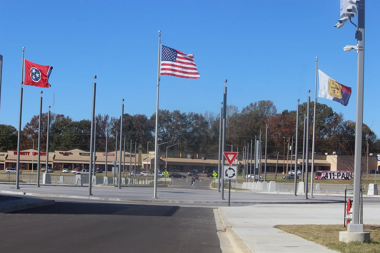
Raleigh, the city's Raleigh planning district north of the Wolf River, is mostly ZIP code 38128 and split among Raleigh-Egypt, Craigmont and Kingsbury high zones.
Last checked Oct. 18, 2026. Sources: the City of Memphis’s Memphis 3.0 planning districts and district boundary layer, the Memphis 3.0 Comprehensive Plan, 2021 update (PDF), the city’s parks layer, Memphis-Shelby County Schools’ School Zone Locator, the Tennessee Department of Education’s 2024-25 letter grades, the Zillow Home Value Index, 2020 Census block counts and OpenStreetMap. Memphis 3.0 planning office: 901-636-6601.
Raleigh is the city’s northeast side, north of the Wolf River, and one of the 14 planning districts in the city’s Memphis 3.0 comprehensive plan. About 51,500 people lived in it at the 2020 census, in about 21,900 homes, by our count of Census blocks inside the district line. OpenStreetMap marks the places Raleigh and Egypt inside it.
What this means for you
- High school: split; about half of residents are zoned for Raleigh-Egypt High, a third for Craigmont High and the rest for Kingsbury High.
- Home value: Zillow’s typical value in ZIP code 38128 was $143,481 in September 2026.
- Interstate: I-40 Exit 8B (State Route 14, Jackson Avenue) is about 1.7 miles from the district’s population center.
Where it is
On the city’s district map, Raleigh runs from the Wolf River on the south and southwest to the Loosahatchie River on the north, with a CN rail line on part of its west side. Its east side follows Old Brownsville Road, Stage Road and Summer Avenue in places. Main roads inside include Austin Peay Highway, Covington Pike, Yale Road and Raleigh-LaGrange Road. About 70% of residents are in ZIP code 38128, 26% in 38134 and 4% in 38135.
The comprehensive plan makes Austin Peay and Yale an urban center: the site of the former Raleigh Springs Mall, now Raleigh Town Center, with a lake and a one-mile walking trail, green space, a skate park, a police precinct and a public library. The plan says a small area plan for it was completed in 2019 and that about 30 acres were left for later development. It also names a neighborhood crossing at Raleigh Egypt. The plan’s district map of places residents named in workshops includes the neighborhoods Scenic Hills, Twin Lakes, Windermere, Eppingway, Hickory Bluffs and Raleigh Ridge.
Schools
Memphis-Shelby County Schools assigns schools by address. In the zone data behind its School Zone Locator, the district splits three ways at the high school level:
| School | Address | Share of 2020 residents zoned | 2024-25 state grade |
|---|---|---|---|
| Raleigh-Egypt High (grades 6-12) | 3970 Voltaire Ave. | 51% | B |
| Craigmont High | 3333 Covington Pike | 34% | C |
| Kingsbury High | 1270 N. Graham St. | 14% | D |
| Raleigh Egypt Middle | 4215 Alice Ann Drive | 51% | F |
| Craigmont Middle | 3455 Covington Pike | 34% | B |
| Kate Bond Middle | 2737 Kate Bond Road | 14% | F |
| Scenic Hills Elementary | 3450 Scenic Highway | 32% | C |
| Brownsville Road Elementary | 5292 Banbury Ave. | 17% | B |
| Raleigh-Bartlett Meadows Elementary | 5195 Twin Woods Ave. | 17% | D |
| Shelby Oaks Elementary | 6053 Summer Ave. | 14% | B |
| Egypt Elementary | 4160 Karen Cove | 13% | C |
Grades are from the Tennessee Department of Education’s 2024-25 A-F letter grade file; addresses are from the federal NCES school directory. Because the area is split, check one address in the locator. More in our schools guide.
Home values
According to the Zillow Home Value Index (Zillow Research):
| Area | September 2026 | September 2025 | Change |
|---|---|---|---|
| ZIP code 38128 | $143,481 | $147,091 | -2.5% |
| ZIP code 38134 (Zillow files it under Bartlett) | $222,769 | $220,470 | +1.0% |
| City of Memphis | $151,794 | $156,121 | -2.8% |
The index is a modeled typical value for the middle third of homes, not a sale price. ZIP code 38134 reaches into Bartlett, so its figure covers more than this district. More in our home prices guide.
Parks and trails
From the city’s parks layer:
- Oakley Park, about 690 acres, and John F. Kennedy Park, about 296 acres at 4577 Raleigh-LaGrange Road (address from OpenStreetMap).
- The Epping Corridor (about 125 acres), Walker Hall Park (83), Willingham Park (70), Egypt Central Park (25) and Pierotti Park (25).
- The walking trail around the lake at Raleigh Town Center, described in the city’s plan.
The Raleigh Library is at 3452 Austin Peay Highway. More in our parks and trails guide.
Getting around
- I-40: from the district’s population center, Exit 8B (State Route 14, Jackson Avenue) is about 1.7 miles, Exit 6 (Warford Street) about 2.7 miles and Exit 10 (Covington Pike, State Route 204) about 3 miles, as the crow flies (OpenStreetMap).
- Distances: about 11.8 miles by road to City Hall downtown and 14.6 miles to Memphis International Airport, measured on the OpenStreetMap road network. These are distances, not drive times.
- Buses: in the Memphis Area Transit Authority’s latest public schedule data we could download (a February 2025 feed), Routes 11 Frayser, 19 Vollintine, 32 Hollywood and Hawkins Mill, 37 Perkins, 40 Stage and Lauderdale and 52 Jackson stop in the district. Routes change; check the MATA routes page or call 901-274-6282. More in getting around.
Groceries and everyday stores
From OpenStreetMap:
- Kroger, 3860 Austin Peay Highway; Walmart Supercenter, 3950 Austin Peay Highway; Aldi, 3176 Austin Peay Highway.
- Superlo Foods, 2155 Covington Pike.
- Barakat Middle Eastern Market, 5782 Raleigh-LaGrange Road.
- Walgreens, 5080 Stage Road, and on Yale Road and Walter K. Singleton Parkway.
More neighborhoods
Raleigh is one of the areas in our Memphis neighborhoods guide. Next door: Frayser to the west and Cordova to the southeast.
Map data © OpenStreetMap contributors. District boundaries and parks: City of Memphis. School zones: Memphis-Shelby County Schools. Population and ZIP codes: U.S. Census Bureau.
Frequently asked questions
Where is Raleigh in Memphis?
In the northeast part of the city, north of the Wolf River. On the city’s Memphis 3.0 district map, the Raleigh District reaches the Loosahatchie River on the north, with a CN rail line on part of its west side.
What high school serves Raleigh in Memphis?
It depends on the address. In Memphis-Shelby County Schools’ zone data, about 51% of the district’s 2020 residents were zoned for Raleigh-Egypt High (a B on Tennessee’s 2024-25 letter grades), 34% for Craigmont High (C) and 14% for Kingsbury High (D).
What is the typical home value in Raleigh, Memphis?
In ZIP code 38128, which covers about 70% of the district’s residents, Zillow’s typical value was $143,481 in September 2026, down 2.5% in a year, according to the Zillow Home Value Index.
What is at the old Raleigh Springs Mall site?
Raleigh Town Center, which the city’s comprehensive plan says has a lake with a one-mile walking trail, green space, a skate park, a police precinct and a public library. The Raleigh Library is at 3452 Austin Peay Highway.
Have your say