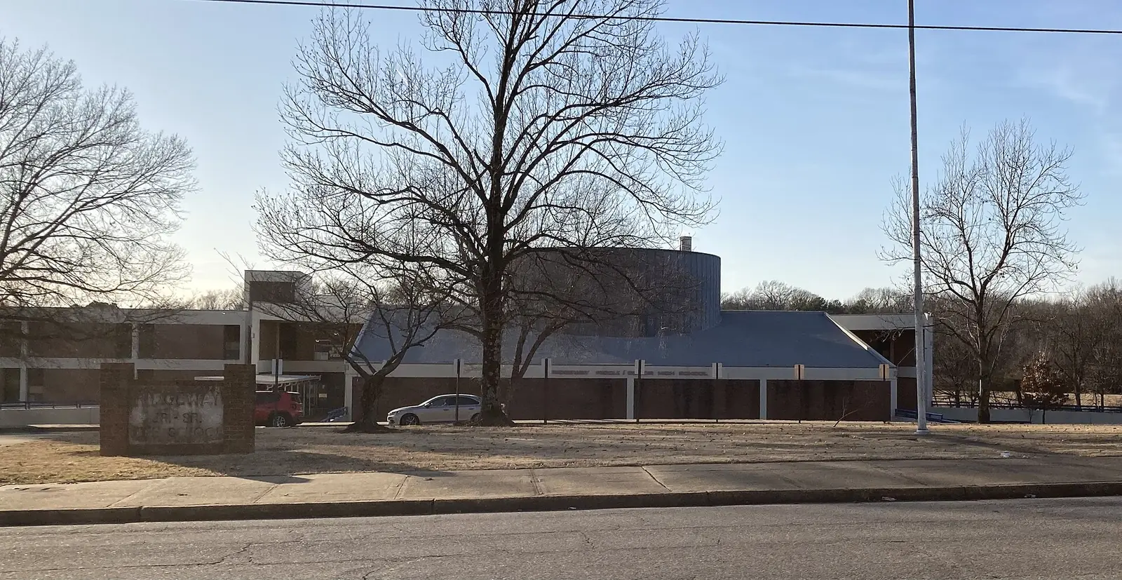
East Memphis, the city's East planning district along Poplar Avenue, spans ZIP codes 38119, 38120 and 38117 and splits between Ridgeway and White Station high zones.
Last checked Oct. 18, 2026. Sources: the City of Memphis’s Memphis 3.0 planning districts and district boundary layer, the Memphis 3.0 Comprehensive Plan, 2021 update (PDF), the city’s parks layer, Memphis-Shelby County Schools’ School Zone Locator, the Tennessee Department of Education’s 2024-25 letter grades, the Zillow Home Value Index, 2020 Census block counts and OpenStreetMap. Memphis 3.0 planning office: 901-636-6601.
East Memphis is the city’s East District in the Memphis 3.0 comprehensive plan, the office and shopping corridor along Poplar Avenue and the neighborhoods north and south of it. About 48,000 people lived in it at the 2020 census, in about 22,800 homes, by our count of Census blocks inside the district line. OpenStreetMap marks East Memphis, White Station, River Oaks, Brookfield, Greenlawn and Southwind inside it.
What this means for you
- High school: split; about 43% of residents are zoned for Ridgeway High and 41% for White Station High.
- Home value: Zillow’s typical value in ZIP code 38119, the largest share, was $288,176 in September 2026.
- Interstate: I-240 Exit 15 (Poplar Avenue) is about a mile from the district’s population center.
Where it is
On the city’s district map, East Memphis runs from the Wolf River and Humphreys Boulevard on the north to Nonconnah Creek on the south, with Mount Moriah Road and Mendenhall Road along much of its west side. I-240 crosses the west part of the district. Main roads inside include Poplar Avenue, Ridgeway Road, Kirby Parkway, Park Avenue and Winchester Road. About half of residents are in ZIP code 38119, 30% in 38120, 16% in 38117 and 3% in 38125.
The comprehensive plan calls the East District an important employment center for the city and names two urban centers on Poplar Avenue, at Truse and at Ridgeway, and a neighborhood crossing at Sea Isle. It says the district is projected to gain 1,305 multifamily units through 2040, likely along Poplar Avenue. The plan’s district map of places residents named in workshops includes the neighborhoods White Station, Sea Isle, Balmoral, Richland Acres, Briarwood, Poplar Estates, Greentrees, Kirby Trace and Windyke.
Schools
Memphis-Shelby County Schools assigns schools by address. In the zone data behind its School Zone Locator:
| School | Address | Share of 2020 residents zoned | 2024-25 state grade |
|---|---|---|---|
| Ridgeway High | 2009 Ridgeway Road | 43% | B |
| White Station High | 514 S. Perkins Road | 41% | A |
| Overton High | 1770 Lanier Lane | 13% | D |
| Ridgeway Middle | 6333 Quince Road | 56% | D |
| White Station Middle | 5465 Mason Road | 28% | A |
| Colonial Middle | 1370 Colonial Road | 13% | B |
| Balmoral/Ridgeway Elementary | 5905 Grosvenor Ave. | 35% | A |
| Oak Forest Elementary | 7440 Nonconnah View Cove | 20% | B |
| Richland Elementary | 5440 Rich Road | 16% | B |
| Sea Isle Elementary | 5250 Sea Isle Road | 13% | B |
| White Station Elementary | 4840 Chickasaw Road | 12% | B |
About 3% of residents, on the east edge, are zoned for the Germantown schools that Memphis-Shelby County Schools runs. Grades are from the Tennessee Department of Education’s 2024-25 A-F letter grade file; addresses are from the federal NCES school directory. Check one address in the locator. More in our schools guide.
Home values
According to the Zillow Home Value Index (Zillow Research):
| Area | September 2026 | September 2025 | Change |
|---|---|---|---|
| ZIP code 38119 | $288,176 | $291,835 | -1.3% |
| ZIP code 38120 | $422,325 | $427,242 | -1.2% |
| ZIP code 38117 | $264,140 | $266,189 | -0.8% |
| City of Memphis | $151,794 | $156,121 | -2.8% |
The index is a modeled typical value for the middle third of homes, not a sale price. ZIP code 38117 also covers much of the University District. More in our home prices guide.
Parks and trails
From the city’s parks layer:
- Lichterman Nature Center, about 78 acres, 5992 Quince Road.
- May Park, about 65 acres.
- Sea Isle Park, about 34 acres, 5253 Sea Isle Road.
- Holmes Park, about 20 acres, 2361 Hickory Crest Drive, and Brennan Park, about 19 acres.
- A section of the Wolf River Greenway along the district’s north edge.
The Poplar-White Station Branch Library is at 5094 Poplar Ave. More in our parks and trails guide.
Getting around
- I-240: from the district’s population center, Exit 15 (Poplar Avenue, U.S. 72) is about a mile west, Exit 16 (State Route 385, Bill Morris Parkway toward Collierville) about 1.1 miles and Exit 17 (Mount Moriah Road) about 1.5 miles, as the crow flies (OpenStreetMap).
- Distances: about 12.5 miles by road to City Hall downtown and 12.3 miles to Memphis International Airport, measured on the OpenStreetMap road network. These are distances, not drive times.
- Buses: in the Memphis Area Transit Authority’s latest public schedule data we could download (a February 2025 feed), Route 50 Poplar, Route 57 Park, Route 34 Central and Walnut Grove, Route 36 Lamar and Route 53 Summer stop in the district. Check the MATA routes page or call 901-274-6282.
Groceries and everyday stores
From OpenStreetMap:
- Kroger, 6660 Poplar Ave., 799 Truse Parkway, 540 S. Mendenhall Road, 2835 Kirby Parkway and 7942 Winchester Road.
- Whole Foods Market, 5014 Poplar Ave., and Target, 5959 Poplar Ave.
- Walmart Supercenter and ALDI, on Winchester Road at 7525 and 7520.
- Walgreens and CVS Pharmacy, on Poplar Avenue, Kirby Parkway, Ridgeway Road and West Massey Road.
More neighborhoods
East Memphis is one of the areas in our Memphis neighborhoods guide. Next door: the University District to the west, Hickory Hill across Nonconnah Creek and Cordova across the Wolf River.
Map data © OpenStreetMap contributors. District boundaries and parks: City of Memphis. School zones: Memphis-Shelby County Schools. Population and ZIP codes: U.S. Census Bureau.
Frequently asked questions
Where is East Memphis?
On the city’s Memphis 3.0 map, the East District runs from the Wolf River on the north to Nonconnah Creek on the south, with Mount Moriah and Mendenhall roads along much of its west side. Poplar Avenue runs through the middle.
What high schools serve East Memphis?
In Memphis-Shelby County Schools’ zone data, about 43% of the district’s 2020 residents were zoned for Ridgeway High (a B on Tennessee’s 2024-25 letter grades), 41% for White Station High (A) and 13% for Overton High (D).
What is the typical home value in East Memphis?
In September 2026 Zillow’s typical value was $288,176 in ZIP code 38119, $422,325 in 38120 and $264,140 in 38117, according to the Zillow Home Value Index. The citywide figure was $151,794.
What interstate exit serves East Memphis?
I-240 Exit 15 (Poplar Avenue, U.S. 72), with Exit 16 (State Route 385, Bill Morris Parkway) and Exit 17 (Mount Moriah Road) to the south.
Have your say